Austin Airport Map [Parking, Hotels, Terminals, Flights]
The Austin Airport Map serves as an invaluable tool for travelers navigating Austin-Bergstrom International Airport (AUS). This comprehensive map provides an overview of the airport’s layout, highlighting key facilities, terminals, concourses, and important points of interest.
Whether you’re a first-time visitor or a frequent traveler, the Austin Airport Map is your guide to a seamless and stress-free experience at this bustling airport. This introduction will provide an overview of what travelers can expect from the Austin Airport Map and how it can enhance their journey through AUS.
Austin Airport Map (AUS)
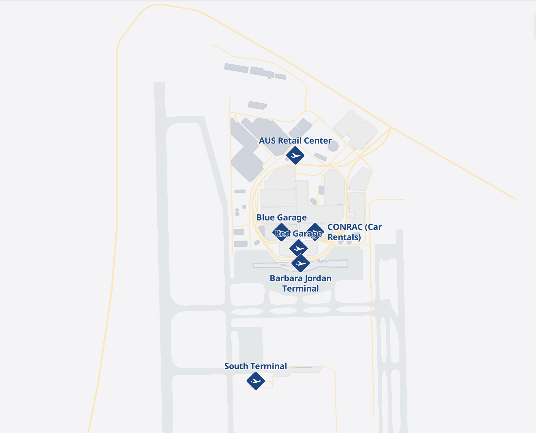
The Austin-Bergstrom International Airport (AUS) map serves as an invaluable resource for travelers embarking on their journey to or from Austin, Texas. This comprehensive map provides a detailed overview of the airport terminal’s layout, offering precise information on gate locations, baggage claim areas, security checkpoints, and other essential facilities. Additionally, the map highlights key features such as parking lots, ground transportation options, and various amenities.
Travelers can access the AUS map through both online and print formats. The online version offers an interactive experience, allowing users to zoom in and out to explore different areas within the airport. Alternatively, the print map is readily available at the airport’s information desk and can be found at multiple locations throughout the terminal.
The Barbara Jordan Terminal is the main terminal at AUS and is where most airlines operate. The South Terminal is a smaller terminal that is used by a few select airlines. Travelers who are flying into or out of the South Terminal should be sure to check the map to familiarize themselves with the layout of the terminal and to find the location of their airline’s check-in counters and security checkpoint.
The utility of the AUS map extends to several areas:
- Navigational Aid: The map proves indispensable for travelers seeking efficient navigation throughout the airport, ensuring they can easily find their way to their intended destinations.
- Locating Vital Facilities: Travelers can rely on the map to pinpoint critical facilities such as departure gates, baggage claim areas, and security checkpoints, streamlining their airport experience.
- Route Planning: The map is a valuable tool for planning travel routes, allowing travelers to chart their path through the airport with ease.
- Time Estimation: Travelers can make informed decisions about their airport journey by using the map to estimate the time required to travel between different points within the terminal.
Ultimately, the Austin Airport Map simplifies the airport experience, offering convenience and guidance to travelers as they navigate Austin-Bergstrom International Airport.